Monday 24 April 2017

To the Nothern Tip of Indonesia

Devastation caused by landslide
Leaving Medan we headed back to the mountains and followed the road up through the spine of the country towards Gunung Leuser National Park - a huge area of mountains covered in untouched rain forest. The road follows a beautiful river valley which has been cultivated with the jungle rising up on either side.
Masonry house destroyed by landslide
Approaching one village on the road we met first saw many heavy vehicles and military and police personnel. Entering the village, many people were sitting round in groups talking quietly, and then we saw why. For around 1km the hillside had been washed down through the village, destroying their timber houses, overwhelming bridges and blocking rivers. We had seen images on the TV news a couple of days previously which said 8 people were killed. A massive clean up operation was in progress with diggers, and rescue teams and emergency food stations. It is only when you see the effect directly that you can appreciate the scale and devastation caused to these relatively poor rural communities.
Female wild OrangUtan
Mother with baby OrangUtan
The main road through Gunung Leuser passes through some areas of prime forest, and we were fortunate to see a family of wild OrangUtans feeding on a tree right beside the road. We managed to camp by the river and again saw them feeding in the same tree the following morning along with a pair of the ridiculous Rhinoceros Hornbills.
Gunung Leuser National Park
Rhinoceros Hornbill 
Start of forest clearance
Deciding to cut through to the west coast we followed a minor road which climbed through the untouched forest to 1600m. Sections of the road are in a very poor state and we used the 4WD capability of the Landcruiser a couple of times to overcome very steep and muddy sections.
From the west coast this road is controversially being upgraded, widened and surfaced and it soon becomes clear that where there is easy access the forest is soon cleared for the timber and for agriculture. Poignantly just before we reached the start of the forest clearance we were privileged to spend 3/4 hour watching a family of wild gibbons feeding and displaying their acrobatic abilities in a tree by the road.
Beautiful coast of Aceh Province
White Handed Gibbon
Having reached Aceh Province we were now in the area devastated by the 2004 tsunami and the west coast has many new houses and a fantastic new road which sweeps along the coastal plain to Banda Aceh in the north. This beautiful coastline of palm lined sandy beaches and rocky headlands feels very undeveloped and tranquil. Without stopping to see Banda Aceh we caught the ferry to Pulau Weh where we applied for a visa extension and due to a weekend and public holiday had to stay for a week. A beautiful island containing the northern most point of Indonesia (kilometre 0) with coral gardens and excellent snorkelling just a few metres from the beach provided an ideal place to relax for a few days before we start our journey south.        


Most Northely point of Indonesia 


Pulau Weh Campsite
Sunset from Pulau Weh Campsite

Wednesday 12 April 2017

Crossing the Equator and Driving inside Volcanoes

The Caldera and Lake Maninjau
Minang Palace
The north of Sumatra has had some of the largest volcanic eruptions in history. In the past week we have driven round the inside of two old caldera, Lake Maninjau near Bukit Tinggi which erupted around 55,000 years ago and left a caldera 30kms by 8kms, now filled with a lake. We spent the night on the rim, then drove down the 44 hairpin bends on the road into the caldera. Once it was a developing tourist destination, but when tourism declined they turned to fish farming, with numerous nets of farmed tilapia. A road runs round the lake under the rim where landslides are a hazard and emergency escape signs and paths have been created. Every possible area of the caldera edges is farmed, the shallower places for rice, and the steeper slopes for vegetables.
Into the Northern Hemisphere
Having explored further the Minang culture with a visit to a traditional village centred round the mosque, a long meeting house, and the kings palace, recently rebuilt after a fire caused by lightening destroyed it in 2007, we headed north to Lake Toba, crossing the equator en route. As we moved into the province of North Sumatra from Central Sumatra there was a sudden change, as all the villages now had one or more Christian churches, and hardly a mosque in sight. North Sumatra also appeared much poorer with the villages frequently comprising of many very small wooden houses, and the minor roads to the villages in a very poor condition, although much work is underway to improve them.
Sumatra Surili Mitered Leaf Monkey
We climbed steadily until the turn off to Lake Toba when we started to drop down a steep cliff with spectacular views into the caldera. Lake Toba is huge - 100kms long by 30kms wide - and was created by the explosion of a supervolcano around 70,000 years ago - believed to be the largest explosive eruption on earth in the last 25 million years. 2,800 cubic kilometres of rock were ejected with the ash from the eruption leaving significant deposits in Lake Malawi in Africa and up to 9m of ash in India! Global temperatures are believed to have dropped by between 3 and 5 degrees Celcius for several years. The centre of the caldera has now flooded creating a huge lake, but uplift of the centre of the caldera has created a large island within the lake. We spent a day driving round the island, passing through lots of villages where the traditional Batak houses dominate and are still a significant part of the community. The caldera seems to create its own weather with clouds hanging over and along the walls and rain storms sweeping across the lake. Waterfalls cascade down the rim walls, which rise 800m from the lake, fed by the regular rain storms. Unlike most of Sumatra the forest on the rim is mainly conifer and there is a lot of natural grassland surrounding the caldera.

Batak Village
Needing to renew our visas we have now dropped down into Medan to visit the immigration office, and we will try and get the wheel bearings greased / replaced as they are running hot, not surprising after the hammering they have taken on the broken tarmac roads here in Indonesia. Once all sorted we are heading to the northern tip at Banda Aceh.


Lake Toba


Brahminy Kite

120m waterfall into lake Toba


Tuesday 4 April 2017

Volcanoes, Lakes and Gibbons

Concentration required when driving
Our morning view over Lake Kerinci
Another week in Sumatra and we have made a little progress north - it is such a large and fascinating island. We have now reached Padang where we have stayed for a couple of days while some essential work is being carried out on the Landcruiser. The bushes on the rear springs are in poor condition and a seal on the front steering is leaking, all due to the severity of the potholes in the roads.
Remarkably all the roads here are surfaced, many recently, providing an excellent driving surface, but then many sections are in terrible condition with large sharp edged potholes causing heavy jolts to the suspension. Bizarrely the worst roads tend to be the main roads which carry the heavy lorries. These both break up the surface and in turn make them very slow as they try to avoid the worst of the holes.

The Gong Stone
Driving the main roads is frustrating as it is slow and there are always motorcycles weaving in and out of the traffic - concentration is essential. The side roads are fantastic, but often not signposted, or on any of our maps so again we have tried pot luck with some beautiful scenery.
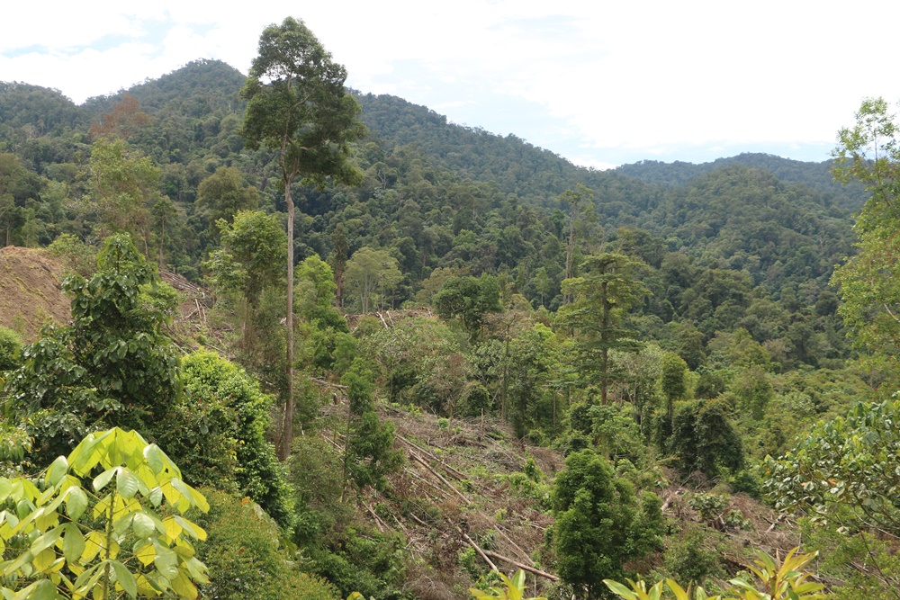
From Bangkalun we have moved some 500kms up the coast to Padang, but have taken in some beautiful mountains, with the benefit of cooler, but wetter, weather.

Kerinci Volcano dominating the tea plantations
We spent several days in the Kerinci valley, seeing more 3000 year old carved stones, and climbing another extinct volcano (Gunung Tujuh) to see the lake in the caldera. A steep climb up a muddy and root strewn path led to a beautiful lake surrounded by steep tree clad walls of the old crater. We managed to get down just as a thunderstorm broke. Gunung Kerinci is the highest volcano in S E Asia at 3,800m and dominates the area, with large tea plantations on its flanks.

Path up Gununh Tujuh
Gunung Tujuh Crater Lake
From Kerinci we headed north on the minor roads eventually moving into the Minang tribal area where their characteristic peaked houses are a key feature of the landscape. As we were wandering along the village looking at the houses a reporter for a local radio station stopped and interviewed us, then spent half an hour showing us around, including arranging for us to visit one of the traditional houses. We later discovered, when visiting the museum in Padang that the piece had been broadcast and our photo and story shared with staff at the museum. There seem to be very few western visitors to Sumatra - everywhere we go we are asked for photos and people want to talk to us - incredibly friendly and welcoming.
Traditional Minang House
Traditional Minang Street with rice drying
As we drove round the Lake Singkarak area on Sunday morning we were surrounded by motorbikes and pickup trucks packed with people and their dogs - all heading down one narrow road. There must have been hundreds and hundreds of dogs congregating, seemingly for one of their favourite past times of hunting wild boar. The area round the lake is beautiful, terraces of paddy fields amongst coconut palms, all backed by forest rising up the surrounding mountains. It is interesting that as the climate is constant all year round the rice is in every stage of growth, some paddies being ploughed, whilst nearby they are planting, and harvesting from other paddy fields. So good is the climate and so fertile the soil they get three harvests per year.
Parking up that night we were again privileged to have a troupe of Sumatran Surilli Mitred Leaf Monkeys cross near our van and then roost in some nearby trees for the night.
From here we plan to head to Bukit Tinggi and spend some time in the hills and lakes of this most traditional Indonesian cultural area before heading north to Lake Toba.

Rich decoration on traditional Minang house


Rice Paddies - notice rice at all stages,
from just planted to ripe for harvest
Rice Paddies


Sumatran Surilli  - Mitred leaf monkey settled for the night