 |
| Coromandel Peninsula |
Our first stop south of Auckland took us to the beautiful Coromandel Peninsula, the northern end of a range of mountains which sticks out into the sea off the east coast. A single road winds along the coast to the northern tip where we found a fantastic coastal camp site and a beautiful walk along the cliff tops. To reach the eastern side we had to return along the coastal road and take a small gravel road through the mountains.
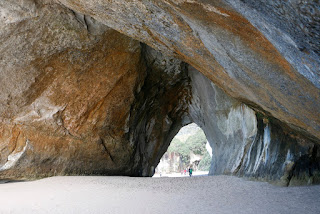 |
| Cathedral Cave |
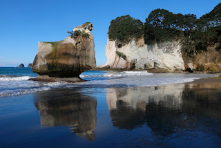 |
| Cathedral Cove |
Dropping down on the east side we stopped at hot beach - two hot springs emerge at the edge of the beach and flow down to the sea, and lots of people were digging their own hot tub in the sand, OK when you are under the water, but a very chill wind off the sea for exposed parts of the body. A few kms down the coast is Cathedral Cove, where a large arch has been formed by the sea and when the tide is low you can walk through the arch to the next beach - near sunset is was quite beautiful. After a glorious weekend Monday dawned drizzly so we drove to Waihi - a current gold mining town with a long history where the hundreds of kms of tunnels cut in the late 1800's and early 1900's have now been excavated as a huge open pit, with much newer tunnels dug under the town - all to extract a very small percentage of gold. The small local museum had some excellent displays of the history and the lady managing the museum provided lots of information about the current issues as the mine want to extend the pit even further. Just down the valley is another gold mining area where lots of the legacy of the mines can be seen, including a walk along the old railway, through tunnels beside the river gorge.
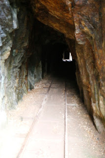 |
| Rail tunnel to gold mine |
 |
| House sit |
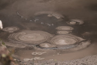 |
| Boiling mud Pools |
We had another 4 days house sitting in a fabulous location about 20kms inland, but elevated so we could see the sea, and had the pleasure of looking after their dog and two ponies. It was a great relaxing time enjoying the sun, views and space. As we retuned to the van and headed to
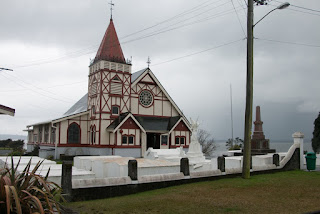 |
| Maori Church in Rotorua |
Rotorua the weather turned wet again for a couple of days, but we enjoyed seeing the steaming lakes and bubbling mud pools, and were fascinated by talking to the warden at a Maori church about the issues facing Maori's today. A tour round another Maori village gave insights into how the locals used the thermal springs and water in their everyday life, including for cooking.
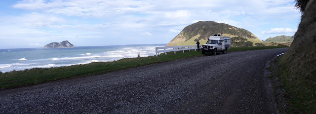
With the weather in the centre and west looking poor we headed to the dramatic east cape of New Zealand, a mere 150kms from 180 degree line of longitude and a place accessed along a long gravel road with little habitation, it felt like the edge of the world. The rocky shoreline is home to beautiful paua shells, and we enjoyed a couple of hours scouring the shoreline collecting some samples.
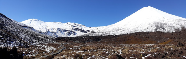 |
| Tongariro and Mount Doom |
Afetr a few days we headed back to central N Island and the volcanic region around Lake Taupo where the weather cleared to sparkling sunny days (and cold nights) and again lots of thermal vents, and stunning snow capped volcanoes including Mount Doom from Lord of the Rings. We managed several kms along the Tongariro crossing path before we reached the snow line, but as we only had trainers decided not to progress further, hopefully Ed will walk it on our way back north in November.
 |
| East Cape - just 80 miles from 180 degrees longitude |
 |
| Male NZ Fur Seal |
We completed the tour of the north island by driving down the west coast with a couple of lovely campsites on the coast where we watched the locals fishing for white bait, before arriving at Wellington. The sunny weather had continued and we walked to Devils Gate to see the seal haul out - male seals rest up there to prepare for the mating season due to start in September. Wellington is a working port and is built entirely focussed on the harbour with the ferries to South Island departing from the centre of town.
We had a fantastic crossing - one of the most scenic ferry journeys we have taken winding out through the wooded hillsides of Wellington harbour, crossing the rather choppy Cook Straight, then a long trip us the flooded valleys of Marlborough Sound to the tiny port of Picton.
Heading west on South Island we visited the Abel Tasman National park and out to farewell spit and Cape farewell on the north west.
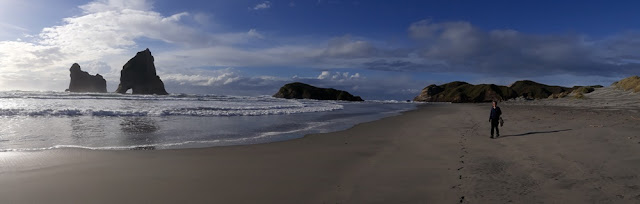 |
| West coast beach near Cape Farewell |
South of cape farewell the mountains of Kharangi National Park prevent any direct road access so we had to first head east then loop round south. Various roads head into Kharangi National Park and we climbed a steep road to the bottom of the Mount Arthur track where we met our first Weka, a ground bird about the size of a chicken, but very inquisitive, having a go at anything left outside. A lovely walk up through beech forests brought us to a rock spur above the treeline where we had fantastic views of snow capped mountains all round.
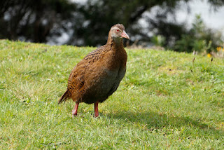 |
| Flightless weka |
The north west coast of south island has long been mined for coal, and we visited Denniston where coal was lowered from the 600m high plateau down an inclined plane, right up until they stopped mining here in the 1960's. Lots of the old equipment is still lying round with excellent explanatory boards describing the processes.
At the northern end of the road another access the Kharangi National Park took us to the Oparara basin, a syncline of the limestone lying directly on top of granite where the water had eroded a couple of spectacular arches, well more like tunnels, but 20 to 30 metres in diameter.
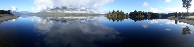 |
| Peaceful morning at Lake Kaniere |
With the weather fantastically clear and settled we then made our way south along the west coast stopping at various interesting rock formations before following the main road to Arthurs Pass. Here we spent a couple of days walking some of the network of tracks and enjoying spectacular mountain views, especially from the lovely camp spot we discovered, where we were surrounded by snow capped peaks.
Dragging ourselves away we have eventually reached Christchurch.
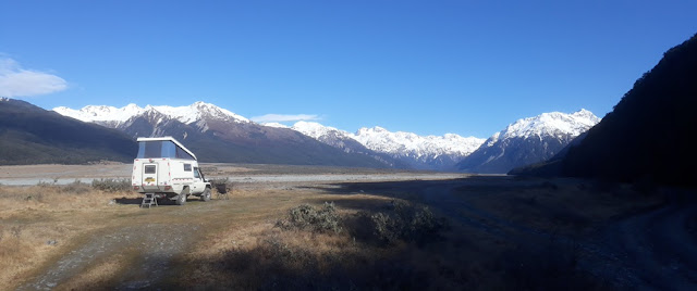 |
| Camping near Arthurs Pass |


