 |
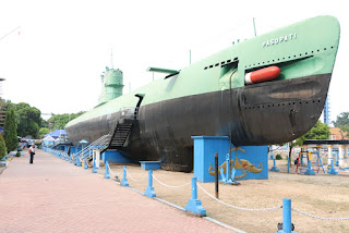
| Ex 1950's Russian built submarine in Surabaya |
After 10 days of chasing different bits of paperwork to satisfy Indonesian Customs we were eventually reunited with our cars and are now exploring Indonesia - often referred to as part of the Ring of Fire.
The 10 days in Surabaya passed reasonably quickly as we exhausted the sights and made a couple of trips out for the weekends when we knew there would be no progress with the cars. Surabaya sights we visited ;
- a 1950's Russian submarine, now on the bank of the river some 10kms from the sea!;
- Samoerna cigarette factory where hundreds of people hand roll local Kreak cigarettes, a mixture of tobacco and cloves;
- China town and the Arab Quarter, where we chose three types of dates from the 20 or so on offer,
- Surabaya Motor Show - with six car manufacturers exhibiting four cars each, and around 10 small stalls mainly selling window film
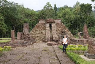 |
| Cetho 10th century Hindu Temple |
- as well as visiting several of the 32 shopping malls around town in search of a road atlas of Indonesia.
After an overdose of city life it was great to be back on the road and exploring this fantastic country. Looking for a respite from the heat and humidity of Surabaya we headed to a group of volcanoes to the south west of the city and spent a couple of days visiting the ruins of some of the 9th century Hindu temples, and enjoying the spectacular scenery of volcanoes rising from the plain.
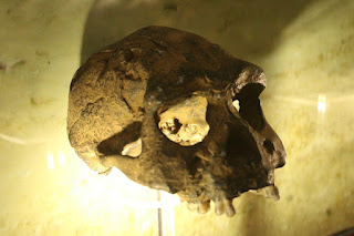 |
| "The Missing Link" - Homo Erectus |
Our route took us to Sangiran, the location where a 2 million year old humanoid fossil of Homo Erectus was discovered which is often referred to as the missing link in human evolution. Three excellent museums provided a huge amount of detail on the history of humans, the history of the discoveries and how they link together as well as an idea of the living environment.
Sumatra beckoned so we lost no time driving the remaining 800kms past Jakarta to the ferry which links Java to Sumartra, where we boarded a modern car ferry which crossed the 30kms in a couple of hours.
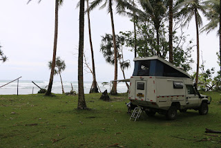 |
| Camping by the Indian Ocean |
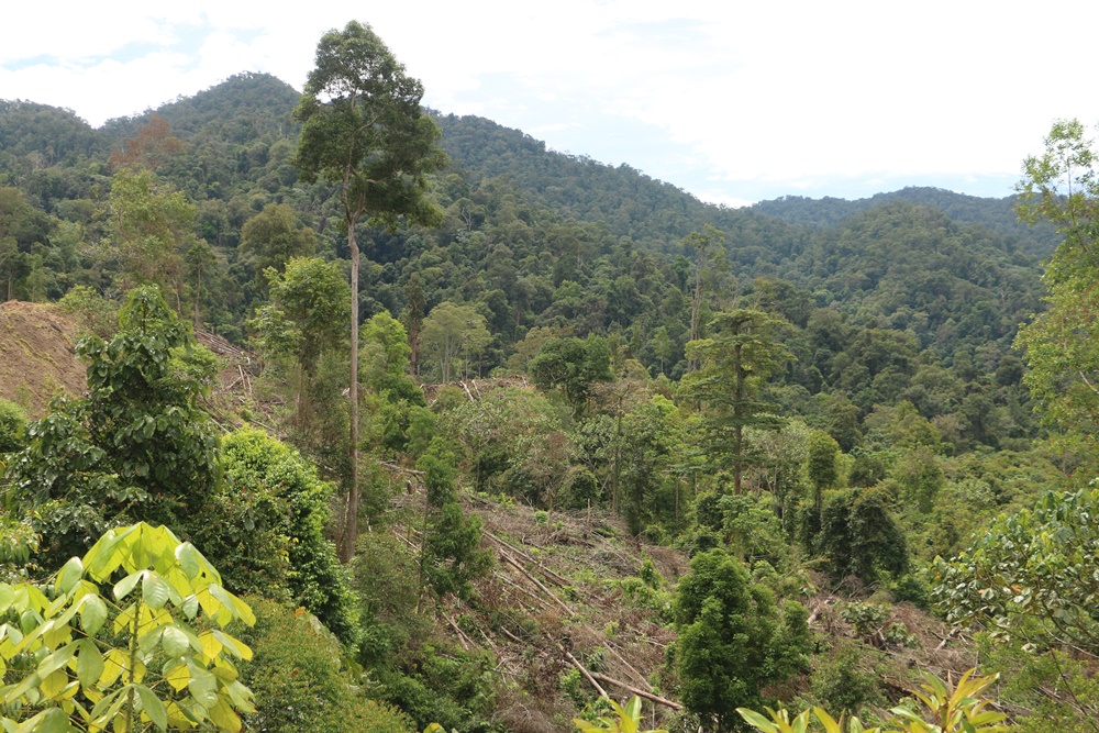
Whereas Java is very developed, Sumatra feels more relaxed with large areas of undeveloped forest. A couple of days parked on the west coast by the sea watching huge waves, driven by a low pressure crash onto the shore provided a rest. It was time to slow down and start exploring, so we headed north into the mountains along twisting switchback roads and were surprised to discover a large elevated plateau being intensively farmed in the cooler climate.
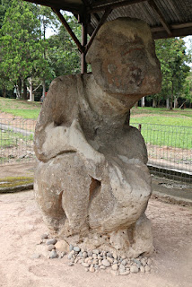 |
| 4000 year old Megalith |
The main purpose was to find some of the hundreds of carved megalithic stones which are scattered across the plateau. With many of the roads not showing on Maps.me, or even on Google Maps there was some try this road, turn round and try another, before we found the stones. We first found the groups at Tinggi Hari, and the following day those around Pagar Alam. No one seems to know the specific purpose of these 4000 year old stones, but many are surrounded by stone burial chambers, The stones themselves are carved representations of people and animals and although many are badly eroded some of the detailed features can still be seen along with remains of the red ochre pigmentation.
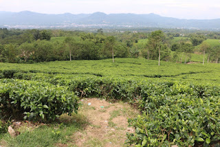 |
| Tea Plantation near beautiful Kapihang |
As there were limited camping possibilities available in the area Kepahing police allowed us to camp in their compound. Their generosity extended to guiding us to the local beautiful tea plantation where we were able to meet some of the pickers and see the lovely views over the city, before being taken to an old tea house where we were treated to local snacks along with tea from the plantation. Sadly the Rafflesia flowers in nearby Curup finished flowering 2 weeks before and just the stump of the previously 3m high flower was left.
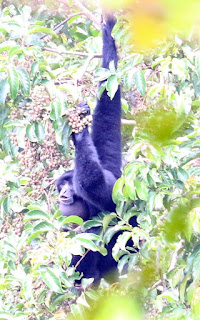 |
| Calling Gibbon |
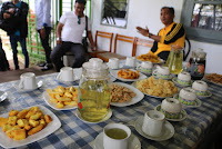 |
| Tea and Snacks |
Curup also offers a relatively easy climb to the top of a Bukit Kaba volcano along a well graded, surfaced path which winds through the forested slopes. As we ascended we were privileged to pass close to a group of very loud calling gibbons, catching glimpses of them as they moved around a tree around 30m away. The final ascent to the crater rim comprises around 250 steps, but the views into the crater with its sulphurous fuming vents is worth the climb. Already we have seen so much and we are only 1/6 of the distance up the west coast of Sumatra.
 |
| Bukit Kaba volcano crater |
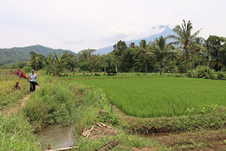 |
| Typical scenery - rice paddies and volcanoes |