 |
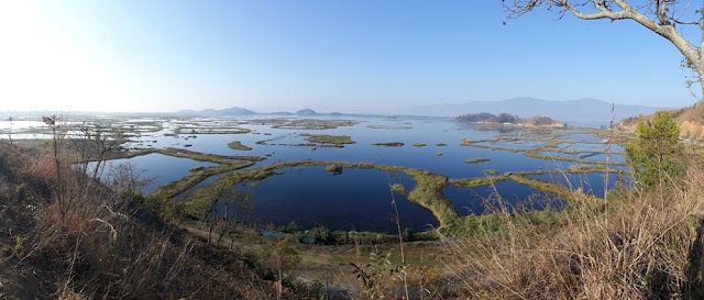
| Shallow Loktak Lake where greenery makes fish breeding compounds |
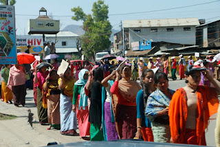 |
| Thousands demonstrate in Imphal |
A couple of days driving from Bagan and we arrived at the border with India. What a contrast - the Myanmar border is two small roadside buildings where we exited the country after having our details captured onto a computer complete with a digital photo. The newly constructed Indian border post is large and clean and guarded by numerous armed military personnel. Here we had our details written into three ledgers before we even entered the country, then several more times at road checkpoints along the only road leading over the mountains. How the Indians love paperwork.
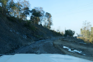 |
| Roads in N E India |
Ironically the ATM's were not working and the only place we could change currency was in Myanmar, so Sue just walked back past the border guards to Myanmar, then returned without any checks!
The Indian side of the border is immediately different, bustling tuk tuks, people, lorries and cars all jostling for position on the dusty streets, and it generally felt much poorer.
Having decided we would head to Lake Toktal 120kms inland we set off, but the badly potholed road, the frequent checkpoints, the very slow antique lorries, and a missing bridge all resulted in it taking 5 hours to complete the 120kms, consequently the last 20kms were completed in the dark - not a pleasant experience.
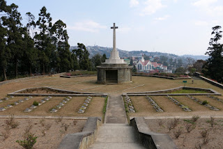 |
| Commonwealth War Cemetery at Kohima |
The North East states of India have only recently opened to tourists, and there is a strong move for independence from India so a large military presence is seen everywhere. It would also appear that there has been little investment in the area, with most people working in agriculture and the roads in appalling condition. Consequently there are many demonstrations as we discovered when we drove through Imphal.
Kohima on the mountain ridge hosts a Commonwealth War Cemetery where the critical battle of Kohima in WW2 saw the allies at last stop the Japanese advance into India. Several thousand graves of mainly British and Indian troops are laid out round the tennis court of the old Governor's residence as the opposing trenches were at each end of the court - the closest trenches of the second world war. These precipitous jungle clad mountain ranges must have been a terrible place to wage war.
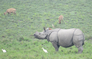 |
| Indian Wild Rhino |
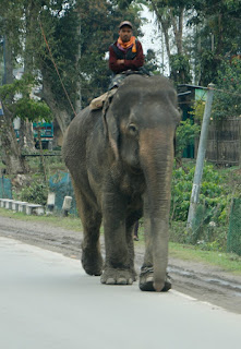
As we dropped down into Assam the road infrastructure improved, and were made aware of how scared locals are of elephants when we were told to turn back as some elephants were grazing the verge of the road. In the end we waited for 20 minutes until they wandered off into the forest. It has been a great surprise how many wild elephant there seem to be, not just in the National parks, but also in general forested areas adjoining agricultural land.
 |
| Another driving hazard |
The main east west road through Assam is in significantly better condition, but it also means more traffic, with apparently suicidal overtaking by cars and lorries in the face of oncoming traffic - something you just have to get used to.
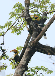
Kaziringa National Park beckoned as it has the largest population of wild Asian one horned Rhino. We camped just outside for a couple of nights and took a morning jeep safari into the park. We were rewarded with sightings of several rhino - quite different to the African Rhino as they appear to be wearing plates of armour. In addition to elephant there are a host of birds.
Assam is a surprisingly large and varied state with huge areas of the flat land by the rivers devoted to tea plantations which run for miles beside the roads.
 |
| Assam tea plantation |
 |
| Living root bridges |
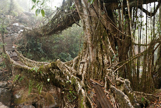
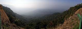
In the south of Assam the land climbs steeply to a range of mountains bordering Bangladesh where the natives have made bridges across the rivers from the roots of fig trees. The road crosses a plateau which appears much like parts of Scotland, except deep tree covered river valleys drop several thousand feet. Approaching the Bangladesh border the land suddenly drops almost vertically several thousand feet to the Bangladesh plains, and it is in these valleys that the root bridges have been constructed over generations. After descending a rocky road clinging to a near vertical cliff we parked and only had to descend (the climb back up) the 2500 steps into the valley where the bridges are. Hard work, but spare a thought for the porters who carry everything needed by the villagers living at the bottom of the valleys.
 |
| Black Capped Langu |
 |
| Plateau Edge into Bangladesh |
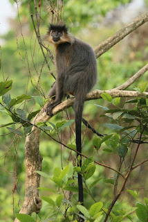
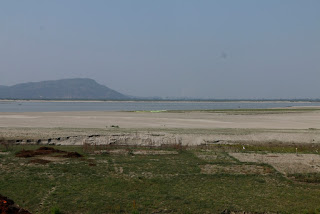
Travelling back north we reached the flood plains of the mighty Irawaddy River, which at this time of year is relatively small, only a couple of kms wide, before heading to the Manas National park bordering Bhutan. After a night camped in the police compound we took a safari through the park, with more beautiful wildlife including black capped langurs, to the Bhutan border, even crossing a few metres into Bhutan.
 |
| Irawaddy River |
 |
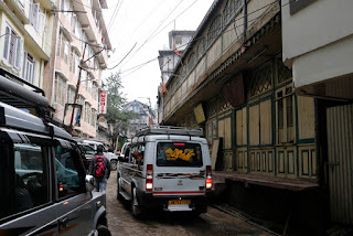
| Darjeeling |
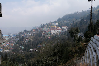
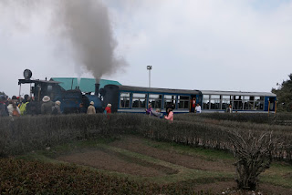
The last few days we have headed further west and north abruptly leaving the plains of northern West Bengal and climbing steeply into the foothills of the Himalaya to Darjeeling. A fantastic road across the ridges climbs the 2000 metres to Darjeeling, but sadly the continuing haze made for poor visibility of the stunning drops to either side. Darjeeling itself is built on the top of a mountain and has dark, narrow and very steep streets, filled with people including lots of tourists from all countries. It was almost continuously shrouded in mist and haze, and very polluted from all the vehicles. Amazingly we were able to camp, along with two French traditional camper vans, right in the centre by the Governors House with permanent security guards on patrol. We took the opportunity to ride on the steam powered narrow gauge railway which was built in the 1880's and in 80kms climbs 7000 ft from Siliguri to Darjeeling. Our trip only went 8kms but was incredible as the small engine puffed its way up 1 in 18 inclines wheels spinning to get grip. With the railway sharing the road with cars and people it is quite chaotic and almost incessant whistling to warn of the trains approach.
 |
| Darjeeling narrow gauge railway |
Our last night in Darjeeling was spent camping just under Tiger Hill - a viewpoint for Kanchenjunga - the third highest mountain in the world - and we were up at 4.30 to join the hundreds of people who had been driven from town to watch the sunrise. Fortunately the clouds kept away long enough to see the mountains, though too much high cloud prevented the sun catching the tops.
Our next stop is Sikkim.
 |
| Road sharing |
 |
| Camp with Kanchenjunga in background |
 |
| Darjeeling traffic |
 |
| Great Hornbill |


No comments:
Post a Comment