Tuesday, 22 October 2019

Into Africa

Drakensberg Mountains
After a few weeks at home we returned to Durban in South Africa to collect our van from the shipping agent. After 120,000kms over some pretty rough roads the van needed some attention including new rear suspension and a full service, so after a recommendation from the local 4x4 club we left the van for a weeks work and rented a car to drive north of Durban and enjoyed a few days relaxing at a cottage at the foot of the Drakensberg mountains, then a few days in a beautiful thatched cottage beside a river near Ladysmith.
The Cottage near Ladysmith
View from cottage deck
British mass Grave nr Ladysmith
Apart from a visit to one of the Drakensberg parks where we walked to a small waterfall, and a visit to one of the battlefield sites relating to the siege of Ladysmith, we spent the time reading and relaxing.
when we were reunited with the van we had just a week to get to Cape Town where we were meeting Sue's brother David, who was joining us for just over to weeks. It was a bit of a dash along the wild coast and garden route, but with fairly persistent drizzle there was little incentive to stop anywhere for long.
Cape Town from Table Mountain
Cape Town is located in a beautiful bay beneath Table Mountain and we spent a couple of days when we visited Table Mountain, via the cable car, and then round to Fish Hoek and the Boulders Bay penguin colony. Despite it being cold and drizzly the penguins provide endless entertainment, some sitting on tiny penguin chicks.
Penguin Colony at Boulders Bay
David was very keen to go cage diving with great white sharks so we drove along to Gansbaai, the centre for cage diving and he spent an afternoon out on a boat, spending three sessions in the cage surrounded by 3m long bronze whaler sharks, sadly no great whites appeared.
Entertaining Penguins
On a more gentle whale watching cruise we were saw around eight southern right whales, and were treated to a mother and baby swimming right in front of the boat.

Fish River Canyon

Beautiful Orange River

With 10 days left we decided to head north to Namibia, spending a couple of long days driving to get to the border at the Orange River, before making our way north via the spectacular Fish River Canyon - the second largest canyon in the world after The Grand Canyon. Tracks along the rim provide a range of vantage points , but being the dry season there were only small pools of water in the bottom.

Quiver Tree Forest
Camping at the Quiver Tree Forest provided the opportunity to see three cheetah at close quarters. They had been orphaned so were rescued and brought up by a couple of greyhounds, and now live in large fenced areas on the farm. The Quiver trees, which are endemic to this region of Namibia grow on the dry rocky land and against the regular beautiful sunsets produce a memorable silhouette.
Dead Vlei Pan Soussousvlei
Namibia offers a range of interesting dry landscapes, and none more enchanting than the worlds biggest sand dunes at Soussousvlei. Although very hot during the day the white salt pans with their trees set against the red of the dunes and the blue sky make for a memorable spectacle. Climbing the dunes, although exhausting, enables you to gain a view of the sand dunes disappearing off into the distance, and in the evening sun the beautiful curves of the dunes are enhanced by the sharp shadows. 
Soussousvlie dunes
In contrast the Skeleton coast with the cold Benguela Current running up it can be very cold. With virtually no rainfall the only moisture available is from the nightly fog which forms for many kilometres inland. This moisture is sufficient to sustain fields of lichens, some of which are hundreds of years old.


Cape Cross Seal Colony
The Cape Cross Seal colony part way along the coast is home to several thousand Cape Fur seals, and we spent several hours watching the mothers feeding their young, as well as an opportunistic Black Backed Jackal which snatched a newly born pup from its mother. Sad, but all part of the realities of life.
Welwytchia Plant
Heading inland from the coast we passed the strange Welwytchia plant, also endemic to this part of Namibia. Welwytchias are very slow growing with some plants believed to be over a thousand years old.
Twyfelfontein Rock Art
Twyfelfontein is home to several thousand ancient rock carvings, some believed to be 5,000 years old. Pictured on the rocks in this valley are many kinds of animals, including seals and penguins from the coast 100kms away, a famous lion with a hand on the end of its tail, believed to be related to a shamanistic rite, and an area of carvings with animals and their spoor which was believed to be a teaching area.
Our final destination on this whistle stop tour was Etosha National Park, where we spent three incredible days/nights watching animals. The first night we were treated to a family of 25 elephant at the waterhole followed later by three black rhino, and even a black and a white rhino at the same time.
Black rhino meets white rhino in Etosha
Across the plains of Etosha the animals congregate near the waterholes, as at the end of the dry season there are few options for water. herds of hundreds of zebra, springbok and wildebeest mixed with oryx, elephant, ostrich, and impala.
Animals concentrated round the waterholes
Oliphantsrus Waterhole on the west provided the most special sightings. A viewing platform has been built right near the waterhole with the platform above the animals, so they are generally unaware of your presence. In addition to the previously seen animals red hartebeest joined the fray. Later during the night rhino and elephant came along with an Eland, and in the distance both a spotted and a brown hyeana. During the night we were woken by loud lion roars just outside the fence from our campsite, and in the morning three male lion were still near the waterhole. Beautiful in the morning sun.
Resting Lion
At our overnight stop on the way back to Windhoek, eland, waterbuck and impala were wandering round the campsite grounds, and David to his delight found a waterbuck antler, which he was allowed to keep. A fantastic few weeks, but very hectic including driving some 6000 kms. We are now ready to slow down for the next phase of our Africa travels.


Mother and baby southern right whale

 
Black Back Jackal

 
Giraffe leaving


Black Rhino                                                                        Lion Brothers


Gemsbok, or Oryx


Busy zebra waterhole

The Baby of the Family


Floodlit Waterhole


Northern Namibia


Thursday, 15 August 2019

Goodbye to the Sub-Continent

Leaving the Swat Valley
The beautiful Swat Valley
Swat Valley is associated with the insurgence of the Taliban who took temporary control in 2007, but is now a peaceful fertile agricultural area growing lots of fruit and vegetables for the markets of Islamabad and Peshawar. This beautiful valley is now a base for the re-assembly of cars smuggled in from Afghanistan on mules and camels to avoid Pakistan's high import duties but which can be openly used in the semi autonomous northern states. Whole towns seem to be full of car parts for any vehicle.
Takht e Bhai Monastery
However the day we were there the monsoon was in full swing at the top of the valley, so we headed south away from the rain to Takht e Bhai - the site of a first century Buddhist monastery complex where students were taught. The remains, scattered over a ridge command wide views over the plains and are believed to be representative of the Buddhist architecture of the time. A few locals were visiting, but we had an armed guard, whether to protect us or the ruins we were unsure.
Greek city of Sirkap
Nearby Taxila was a major town by the Indus and straddling the major route trade from the Khyber Pass east  to India. The area had been occupied for millennia with evidence of Buddhist towns dating from the 5th century BC. A superb collection of artefacts is displayed in the museum, ranging from statues to arms and coins from many countries. Part of the Taxila complex is the ancient town of Sirkap, founded in 180BC by the Greek invader Demetrius and was a fortified by massive walls with a planned grid of streets and temples, some exhibiting typical Greek Corinthian columns, unusual for this part  of the world.

Replacing differential gasket
After a day in Islamabad where we needed to get the front differential gasket replaced, amazingly quick and professional work by the team at Auto Club, we headed to the Indian border, as a state of emergency had just been declared in Kashmir. Crossing back to India we again passed through the gate where the border ceremony takes place and were soon in Amritsar.
Pakistan / India Border gate
There are two iconic places in Amritsar, Jallianwala Bagh - where General Dyer ordered his troops to fire on unarmed locals celebrating their New Year in the gardens, massacring hundreds, and starting the call for independence from Britain. A memorial stands in the garden and the bullet scarred walls have been retained.
Just nearby is the famous Golden Temple - the most holy site for Sikhs and an astonishing place.

Monument to those killed in the
struggle for independence
Despite the thousands of visitors and pilgrims who visit every day there is an air of respect, and a very efficient and unobtrusive process for managing the visitors, from around 15 windows where you can leave your shoes safely with staff, to the mass free feeding of pilgrims as they visit.
Golden Temple Amritsar
There seems to be a permanent queue along the causeway to the temple which is very ornate.

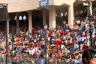
The evening was spent attending the extraordinary border closing ceremony, which has become a major attraction. The crowd on the Indian side starts arriving two or more hours before the ceremony filling the huge stands which have been constructed. Loud lively music is played and despite the heat the crowds dance, sing and wave flags.
Indian soldier at border ceremony
This is then orchestrated by a military cheer leader who encourages the crowd into ever louder cheering with women invited to parade flags and dance in the centre - all very Bollywood. The activity on the Pakistani side is rather more subdued with fewer visitors. The ceremony itself is also extraordinary with soldiers in incongruous uniforms from each country marching towards each other with a high kick before making aggressive gestures in a face off. Finally both flags are carefully lowered in exact timing with each other, before a handshake and the gates are slammed. - All rather strange.

With less than a week until we load the car in Mumbai we headed south along the well made and fast  road, passing Delhi and arriving at Jaipur. The incredible Amber Fort is huge, with walls stretching up and across the nearby hills, looking just like the Great wall of China.
Amber fort at Jaipur
Ornate halls and chambers can be explored at will, with numerous passageways and staircases available to explore. It would be easy to spend a day following all the possible passageways, but with limited time we restricted ourselves to the main areas. The sumptuous tilework and huge proportions make you realise the wealth and power of the Maharajahs.
Worlds largest stone sundial at Jantar Mantar - Jaipur
Jaipur itself is having a metro system constructed so the centre is somewhat disturbed, but the pink city boasts some splendid moghul architecture, especially down some of the back lanes where dilapidated houses often have a very ornate doorway, or lovely balcony.
One of the more unusual places is the Jantar Mantar collection of huge astronomical instruments constructed in the 18th century by a keen Indian astronomer and boasts the worlds largest stone sun dial. Quite extraordinary. Nineteen sets of instruments have been constructed to predict the movement of celestial bodies in each of three coordinate systems.
Udaipur Palace
Our final stop en route to Mumbai was Udaipur where under drizzly skies we visited the huge palace which again has numerous highly decorated rooms and some wonderful architecture, but on a vast scale, with the courtyards separated by low and twisting passageways.
Udaipur ornate interior
In Mumbai we successfully loaded the van into the shipping container ready for its journey to Durban where we will meet it in three weeks time.


Loaded ready to ship to Durban


Highly decorated Pakistani bus

 
Ornate backstreet doorways


Interior of Mumbai railway station


Saturday, 3 August 2019

Beautiful Pakistan

Lahore Fort
When crossing from Amritsar at the only land border open to foreigners between India and Pakistan, we were greeted by big smiles and calls of "welcome to Pakistan" from strangers and border officials alike. A short drive took us to Lahore where we spent a couple of days. The monsoon had just arrived so it was both very hot and humid, but we spent a day wandering through the streets of the walled city, and visited the impressive Lahore Fort and the adjacent huge moghul Badshahi Mosque. A most impressive and beautifully proportioned building.


Badshahi Mosque

With limited time in Pakistan, and wanting to make the most of the mountains, away from the monsoon we headed north towards Islamabad, passing through floodwaters in the streets after a sudden thunderstorm. Cougar Trails in Islamabad offers a refuge for Overlanders with secure parking and a comfortable well equipped room, with all necessary facilities  for relaxing.
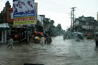
Floodwater on Main highway
Sanaullah who runs Cougar Trails is incredibly enthusiastic about travelling in Pakistan and was very generous in spending time with us, recommending places to visit in the north. Really useful when there are few available guidebooks, and nothing specific for Overlanders about where to stay etc.
Kagan Valley
Setting off north we sped through the lowlands and headed up the beautiful Kagan Valley towards Naran. The Himalaya start to exert their influence with mountains looming wither side of the green valley floor. Recent rainfall had filled many of the side streams with rock debris strewn across the road and small fords to negotiate. Passing Naran, a very busy tourist town packed with Pakistanis on their summer vacation away from the heat of the main cities the road winds up the valley through more rural traditional farming areas to the Babusar Pass at 4180m.
Locals at Babusar Pass
Dropping down through the numerous hairpin bends to the north we joined the famous Karakoram Highway, alongside the Indus River, where we were treated to magnificent view of Nanga Parbat 8126m, one of the most dangerous of the 8000m peaks.
Nanga Parbat
The road to Astore climbs a narrow gorge from the Indus, before opening out into a wide and relatively fertile valley nestled between Nanga Parbat and the Deosai mountains. Here we turned off the main road, climbing a steep rubbly road to a beautiful campsite just below Rama Lake. We had the place to ourselves as we walked up to the lake in the morning, being rewarded with a stunning reflection of the 6500m peaks of Chongra, subsidiaries of Nanga Parbat.
The Deosai Plateu on the way to Skardu offers a completely different landscape. Large open and virtually flat areas of grassland are covered in a profusion of wild flowers of all colours. At around 4000m the night sky is crystal clear with brilliant stars and the Milky Way clearly visible.
Dropping down into Skardu through an increasingly dry landscape we passed small the beautiful Satpara Lake before arriving in the amazingly large and vibrant town set beside the wide floodplain of the swollen Indus River.
Rama Lake
Upstream of Skardu we left the Indus River, and the road to Kargill, just 70kms away in India where we were over a week ago, and followed the Shyok River to Khaplu, an old established small town which boasts one of the oldest mosques and a beautifully restored Fort, really a fortified manor house where the local royal family lived until the 1970's.
With the mountains calling we headed further north towards Hushe. After crossing a very long suspension bridge the valley heads directly towards the beautiful snow covered peak of Masherbrum at 7821m. A stunning drive past near vertical rock walls and glimpses of more high peaks across the valley required a tight several point manoeuver to be able to cross one of the more dynamic suspension bridges - very exciting.
Masherbrum
At the top of the valley is Refugio Hotel where we were welcomed by the owners, and where we camped. We made a couple of short walks up the valley through the lush irrigated fields of wheat, barley and peas all loomed over by the high peaks of the Himalaya. Where there is no irrigation the land is desert and rock. While staying four climbers returned after successfully completing ascents of Gasherbrum 8080m and were met with garlands and celebrations. The Refugio Hotel is at the end of the road, and is the closest point to the peaks of K2, Broad Peak and Gasherbrum, all over 8000m high, so is a natural end point of the climbing expeditions.
Road to Hushe
Returning to Skardu we took the road along the Indus Valley towards Gilgit. This road clings to the often vertical sides of the Indus valley, and is currently being widened in an ambitious project to make it two lanes.
Hushe Valley
Huge quantities of rock are being blasted and hammered from the hillsides to make room, along the whole 175kms of the road. As a consequence there are frequent delays while blasting occurs, and the road is effectively completely unsurfaced. It took us 15 hours to complete the journey, but the views are incredible.
Joining the beautifully surfaced Karakoram Highway we stopped to view the junction of the Indus and Gilgit Rivers. This point divides the three mountain ranges, The Himalaya, The Karakoram and The Hindu Kush, though few of the mountains can be seen.

Road Widening
Gilgit is the main town of the area, though not pretty in itself it is surrounded by mountains and sits beside the Karakoram Highway. The road is now a fast and smooth route with tunnels and scree shelters making easy and fast driving. many Pakistani tourists now drive up to the somewhat unimpressive border with
Indus Valley
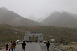
China at the Khunjerab Pass. Pakistan boasts the highest ATM in the world at 4711m, though we did nit test whether it works.
Sanaullah had recommended visiting Pamir Sarai in the Chapursan valley, a guest house run by the knowledgeable, welcoming and fascinating Alam Jan. His stories about expeditions to the Wakhan Corridor and through Afghanistan an entrancing.

Alum Jan and daughter
An at times challenging  road climbs up the beautiful valley through small villages surrounded by fertile irrigated fields with snow capped peaks on either side. At Parmir Seari we were welcomed into Alam Jan's home where we chatted at length about the Central Asia Institute and his brother's involvement with Greg Mortenson in establishing schools across the north of Pakistan and into Afghanistan.
Cathedral Mountains in Hunza Valley
After a wonderful dinner in his traditional home with his family we had a peaceful night. With the Whakan Corridor just up the valley we drove  to the end of the road at the Babu Ghundi shrine.
Hunza Traditional costume
Ant from Australia had spent 10 days chilling and trekking at Pamir Serai, but was ready to move on so we gave him a lift back down to Passau where we planned to take the road to the Shimshal valley, however a landslide the previous day meant the road was blocked for the nest 7 to 10 days so instead we were welcomed to the Passau Peak Inn, opposite the stunning Cathedral Peaks, by the nephew of Alam Jan.
The Hunza Valley is one of the highlights of North Pakistan, and the Karakoram Highway descends through the spectacular scenery. A huge landslide at Attabad in 2010 blocked the Hunza River and destroyed the town of Attabad, creating a large lake which is bypassed by a long tunnel. Petroglyphs just outside Karimabad record the passage of travellers for over 1000 years through this ancient highway, with the stunning restored royal palace at Fort Baltit overlooking the valley.
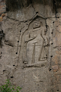
Kargah Buddah
Back at Gilgit we headed west along the Gilgit River, passing the Kargah Buddah, a first century carved buddah in a high rock face just outside Gilgit. This quiet road follows the river through more beautiful scenery before climbing up to the remote Shandur Polo Ground, at an elevation of 3732m claimed to be the highest polo ground in the world. An annual polo festival is held here every year attended by thousands of enthusiasts.
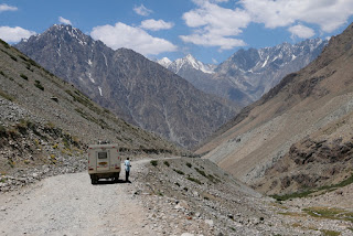
Road to Mastuj
Worlds highest polo ground
The road deteriorates progressively as it descends to the remote small town of  Mastuj, and becomes very interesting as it crosses huge scree slopes and clings to narrow ledges over the river, at times only just wide enough for us to pass. South to Chitral the valley widens with spectacular views of snow clad 6000+m peaks. Passing the rather gloomy town of Chitral we headed for the recommended valley of Bamburait. Despite only being 18kms from the main road the rough, very narrow and low road took 1hr and 30 minutes to negotiate, the last 20 minutes in the dark, so we were relieved to arrive at the PTDC hotel where we could camp.
Costume of Bamburait
The inhabitants of the valley have a unique dress and culture, and are believed to be descended from when Alexander the great invaded the area. Such a peaceful location, which had been devastated by a serious flood in 2015 which washed away half the hotel, and many other houses, leaving boulders some 6ft in diameter scattered across the valley bottom.
With only a few days before we need to return to India we headed south and stayed on a beautiful peach farm in the Swat valley - a wide and fertile valley filled with orchards and fields. Niaz and Shujaat are the most welcoming people and have a wonderful camping area and guest facility.
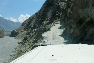
Will we fit ??? !!!
With Niaz and Shujaat at the Peach farm
They could not do enough for us, providing some of the most delicious food, and helping us with some minor repairs to the van. With our tight timescales it was a shame we could not stay longer.


v